We kindly inform you that, as long as the subject affiliation of our 300.000+ articles is in progress, you might get unsufficient or no results on your third level or second level search. In this case, please broaden your search criteria.


The archeological excavations of the walled towns dated back to the period of the Jurchens’ State — the Eastern Xia (1215—1233) — have been conducted on the territory of Primorye for about fifty years. Archeologists have already found more than five hundreds of different types of buildings, including living units, household buildings, administrative and palatial constructions. The Jurchen people used three architectural technologies: column-frame technique, pillar-supported system and a column method. The construction technology helps to determine type and functions of the building. Column-supported buildings with tiled roof were classified as palaces. Some of the palatial residential premises that were excavated on the territory of the Upper Capital City of the Eastern Xia State (Krasny Yar fort) were constructed with use of column and pillars — this type of architectural technology was previously unknown for the researchers. Although the Jurchen architecture was developing within the mainstream Far Eastern architectural tradition, it had their own specific architectural style within the framework of that tradition.
More...
Archaeological and epigraphic sources allow to reveal external (state) and internal (administrative) borders between countries of the South Siberian region in the 6th—14th centuries. So, funerary sites with some Turkic sculptures, well distinguishable from similar objects of other Turkic people, seem to be an indicator of external borders of the First and Second East Turkic khaganates. Where they are absent, there was no Turkic domination. The northern border of the Uigur khaganate is noted by pise-walled fortresses and a 230 km long wall that connects them. Old Khakassia stone fortresses protecting passes in Western Sayan Mountains also show that borders of this country passed across ridges. But with expansion of the country from the second half of 9th century, the rivers became borders. It is evidenced by placement of military cemeteries of the ancient Khakass found on only the right coast of the Irtysh River. Two Mongol towns which had typical buildings for the Mongols, appear to be centers of two administrative districts. The old Khakassia family and personal heraldry is familiar to a series 9—10th centuries connected with marks in epitaphs and rocks, specified hereditary land use, outlining borders of possessions in Tuva and in Khakassia.
More...
The author reviews the current state of studies into Western Kazakhstan sites dated by 13th—14th centuries. The area under research is predominantly represented by sites belonging to the nomadic population of the Golden Horde. The paper describes features of historical and geographical location of funerary sites in Western Kazakhstan. Overall, the archaeological sites identified in Western Kazakhstan are a reflection of some general processes in Eurasian steppes generated by appearance of the consolidated Mongol state, and later by the Golden Horde, and manifested in the uniformity of features of material culture.
More...
The work considers the history of medieval settlements in the steppe between the Dnieper and the Don. It includes the lands of the Donetsk Ridge, the Northern Azov Sea, and the buffer zone between the steppe and the forest-steppe in the middle reaches of the river Severskiy Donets. Steppe open spaces throughout the Middle Ages were the habitat of nomads. In periods of stability, when these lands were part of large state entities, settlements appeared on some of their plots near roads. These roads crossed the steppes in the latitudinal direction, which was connected with the cultural ties of the region, in which the Crimea, the Northern Caucasus and the Lower Dnieper Basin played a prominent role.In the buffer zone, settlements existed during the entire Middle Ages. In the Khazar and Golden Horde times large trade and craft centers grew in the contact zone between the steppe and the forest-steppe. In these settlements, there was also an administration that led the life of the nomadic steppe. The defeat at the end of the 14th century led to the complete collapse of the settled way of life in the region, after which nomadic hordes dominated the lands for two centuries.In this way, the natural factor, cultural and economic traditions, the existence of trade communications and the political situation played an important role in formation of medieval settlements in the Donetsk steppes. The most developed regions were those with long-standing traditions of settled life style.
More...
In her monograph Golden Horde Architecture. Part I. Cult Architecture (Kazan: Otechestvo, 2014), E. D. Zilivinskaya focuses on the Crimean sites. Along with a presentation of buildings from the main regions of Jochi’s Ulus, there searcher also communicates some separate data about mosques, minarets, madrasah, mausoleums and Christian churches on the peninsula, which are often obsolete, distorted or unreliable. The Crimean content of the monograph is based on some scarce sources, while numerous relevant archival materials and publications seem to be unknown to the author. Frequent mistakes in comments to illustrations and an attempt to offer for scientific discussion some blueprints with false graphic information about plans and orientation of the buildings should be treated as some serious shortcomings of this work. In spite of the obvious relevance of this research, an overview of the cult architecture of the Golden Horde Crimea, which is offered in this monograph, should be examined rather critically and requires a review of almost all published data.
More...
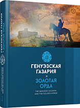
The article primarily focuses on the historical geography of the Crimean territories of the Genoese Gazaria. The Genoese Gazaria is the totality of the Genoese possessions on the lands of the Golden Horde, especially in the coastal areas of the Northern Black Sea, where the medieval toponym “Gazaria” was used to embrace the whole state of the Golden Horde. In general, there were no clear state borders in the Genoese Gazaria: those were coastal zones under the rule of the khans of the Golden Horde, where the Genoese would be given separate quarters in the cities and would enjoy autonomous rights, or would establish their settlements on the coast. The Crimean peninsula was an exception in this system, there the Genoese settled a whole system of cities and rural districts, with clear political and administrative borders. The domain of the Genoese on the Crimean peninsula developed into independent political and administrative system during a long and gradual process, which took a hundred years: from the origin of the main regional center in Caffa (around 1275) to 1387. The author addresses historical geography of the various administrative parts of the Genoese Gazaria on the Crimean peninsula: the rural district of Caffa, Consulates of Soldaia, Cembalo and Vosporo, and possessions on the Southern Coast of the Crimea, the Kerch Peninsula and the Tarkhankut Peninsula. He also analyzes findings of a study into the historical topography of the four fortified Genoese cities — Caffa, Soldaia, Cembalo and Vosporo.
More...
In 1999―2008, the joint expedition of “Tauric Chersonesos” National Reserve and by “V. N. Karazin” National University in Kharkiv investigated the area of the consul’s residence (castle) of the Genoese fortress Cembalo (14th—15th centuries) in Balaklava was located. Excavations on the so-called “consul’s church” found on the territory of the consul’s residence discovered that the church was used by inhabitants as a burial vault. Excavations of tower no.8 and in the adjacent area give some reasons to believe that the tower was part of the fortress’s defensive structures. While digging on site B situated near tower no. 8 we found chamber 3 (constructed in late 15th—16th centuries). The walls of chamber 3 were made of stone shells of predominantly spherical shape. This ‘arsenal’ included 208 shells that weighed 20―104 kg each, which were meant to be used by trebuchet machines against enemy ships. A special platform for trebuchet was constructed on consul’s residence territory. During the excavations of 2007―2008, remains of iron lamellar armor were discovered on the platform. Some peculiarities and circumstances of the find allow us to suppose that the discovered details were fragments of a brigandine, an armor widely spread in the 14th—15th centuries. The armor could belong to an arbalester of the local garrison. So, the Consul’s Castle was the residence of some Genoese official and an important element of the defensive system of the fortress Cembalo.
More...
The archaeological level of the Golden Horde period is analyzed, and this assemblage is compared to the level of the 15th —17th centuries in order to account for a diachronical variability of food resources of animal origin on the Old Orhei site.The study of medieval Old Orhei is mainly focused on the diversity of food resources as reflected by the archaeozoological analysis. Previous archaeozoological studies of the medieval period in Old Orhei discussed aspects related to animal species identified on the site and the proportion of wild and domestic species. The consumers of animal products especially differed by their ethnic belonging. Thus, in the period of Mongol (the Golden Horde) occupation, the main domestic species used in alimentation were the sheep/goat (Ovis aries/Capra hircus), the cattle (Bos taurus) and the horse (Equus caballus), while later — after Mongol retreat, the livestock of the local economy was mainly represented by the cattle (Bos taurus) and the pig (Sus domesticus).The hunting records a very low rate (0.24% NISP) during the Golden Horde period; the low occurrence frequency of wild animals’ remains in this cultural level is quite surprising, since the documents of the time contain information emphasizing that the Mongols used to greatly rely on hunting, which was practiced for different purposes: to compensate a food shortage, to secure furs and hides, to keep fit for future battles, etc.
More...
Glazed pottery finds from Aigai (Aiolis) excavations during 2004—2014 seasons are important finds from Byzantine settlements of Aigai ancient city. While doing studies to uncover Bouleuterion, Agora region and the road system of the ancient city, cisterns (nos. I—II) located in the acropolis of the city and near the agora, the church and the cistern in the northwest of the church have been discovered. Most of them are fragmentary. They are not contextual finds. Still, they are worthwhile in that they present a relative chronology. Late Roman/Early Byzantine period is represented with few finds for now. This period is followed by Middle Byzantine period which have again few finds. Probably these red fabric groups might have come from distant regions. Some of the finds known as Middle Byzantine groups are distinguished because of their similarity to Khalkis production in terms of their form and ornament. We need further information to evaluate white fabric finds. Other distinctive groups in terms of their quality and quantity are from Late Byzantine period of Western Anatolia. These are very similar to the finds from Pergamon, Sardis, Nif (Olympus-Başpınar Church) and The Agora of Smyrna located nearby Aigai. Aigai was on the list of bishopric till the early 13th century. Finds uncovered in Aigai are the first archeological data regarding Aigai ancient city during Byzantine period. Glazed ceramics must be dated to the mid-12th century — early 14th century.
More...
The paper focuses on the detailed presentation of the numerous vessels which are immured in the main wall of the narthex of the church of Panagia Eleousa. The church is located to the north of the village of Kitharida, southwest of Herakleion (Crete). Given their number, their state of preservation, the various categories of pottery to which they belong which were imported from regions of the western and eastern Mediterranean, the particular interest in their disposition and possible hidden symbolic meanings behind their decoration, the vessels constitute one of the most representative groups of bacini immured in Cretan churches. This is corroborated by comparison with the immured vessels from other sites in the Herakleion prefecture and based on the data collected by the research programme focused on bacini in Greece implemented by the National Hellenic Research Foundation in collaboration with the local Ephorates of Antiquities from other Cretan churches.Their detailed study contributes to the history of the church and to the presentation of the types of pottery that were in circulation on the island in the 15th c. AD. Some of these bacini were produced in Byzantine workshops, while most belong to glazed categories imported from the Iberian and Italian peninsulas or the Near East. Special reference is made to their seemingly careful disposition, which would have required specific planning. This observation, combined with the particular decoration on some vessels, which seems to incorporate symbolic meanings, leads to suggestions as to the possible donor who played the leading role in this decoration.
More...
The cross disciplinary comparison of sources enables us to ask questions about objects and practices by analysing and describing the functions, often lost, of certain types of pottery. This article is dedicated to pottery used by Islamic physicians — pots and pans, different types of jars. The texts, general medical manuals and dictionary written in Iraq, Syria, Arabia and Iran between the 8th and 15th centuries are an extremely valuable source of information on medicinal substances, recipes for compound remedies and utensils. A number of illustrations in Islamic manuscript depicting physician activities reflect contemporaneous medical practises. They could sometimes help us to understand the use of objects found in excavations. The archaeological material of my corpus comes from a range of sites in Syria, Lebanon and Iraq. By comparing the data, I present various pottery used in curative medicine in the Islamic world.
More...
The article deals with painted faience produced in the Turkish centre of artistic ceramics in İznik and dated by the end of 15th — 16th centuries. This collection comes from the excavations of 1999—2010 in the Lower Yard of Akkerman fortress in Belgorod-Dniestrovsk, Odessa Oblast, Ukraine. Statistical characteristic of the distribution of finds on architectural objects, as well as typological and chronological classification of materials, has been represented. The authors offer a comparative analysis by functional structure and main periods of development revealed in the Iznik artistic ceramics from Akkerman with collections from a number of the Ottoman provinces’ sites. They also propose a historical interpretation of possible ways how Iznik pottery could appear in Akkerman.
More...
The article considers the collection of medieval ceramics of the National Museum of the Republic of Tatarstan. It includes finds from archaeological sites of Volga Bulgaria and Golden Horde sites in the Volga region. The author traces the history of this collection back to the second half of the 19th century. Findings from F. Ballod’s digs in the Golden Horde’s capital cities, so far little known to the researchers, are of special interest. The author examines main approaches to studying medieval ceramics by Kazan archaeologists in the 20th century and defines various groups of ceramics, mainly from Bolgar hillfort.
More...